
Watch an underwater video recording of the integrated marine geophysical survey for the 'Evolved GE.N.ESIS project' here.
Follow us to an underwater tour of the Methoni ancient breakwater and harbour and watch our ultra-shallow multibeam echosounder survey for the 'Evolved GE.N.ESIS project' here.
Scroll down to watch our fieldwork activities and get to know with Methoni underwater.
Follow us to an underwater tour of the Methoni ancient breakwater and harbour and watch our ultra-shallow multibeam echosounder survey for the 'Evolved GE.N.ESIS project' here.
Scroll down to watch our fieldwork activities and get to know with Methoni underwater.

The Methoni bay and the castle of Methoni. The project team on the survey boat is conducting sidescan and shallow seismic survey.
Photo: K. Tranaka

Bourtzi. The southernmost fortification of the Methoni castle.
Photo: K. Tranaka

The Methoni bay and the castle of Methoni. The project team on the survey boat is conducting magnetometer survey.
Photo: K. Tranaka
Photo: K. Tranaka

The lighthouse on Sapienza island, about a nautical mile off Methoni.
Photo: Panagiotis Gkionis

Precise (RTK) positioning of the ruins of historical shipwrecks in the nearshore zone of the Methoni bay.
Photo: A. Michael

Surveying the underwater antiquities off Methoni and Sapienza island with a multibeam echosounder installed on a RHIB.
Photo: Panagiotis Gkionis

Ruins of a historical shipwreck, lying on the seabed of the Methoni bay. A cannon in the foreground.
Photo: Panagiotis Gkionis

Ruins of a historical shipwreck, lying on the seabed of the Methoni bay.
Photo: Panagiotis Gkionis
Photo: Panagiotis Gkionis

Steering wheel of a historical shipwreck, lying on the seabed of the Methoni bay.
Photo: Panagiotis Gkionis
Photo: Panagiotis Gkionis

Ruins of a historical shipwreck and a cannon, lying on the seabed of the Methoni bay.
Photo: Panagiotis Gkionis
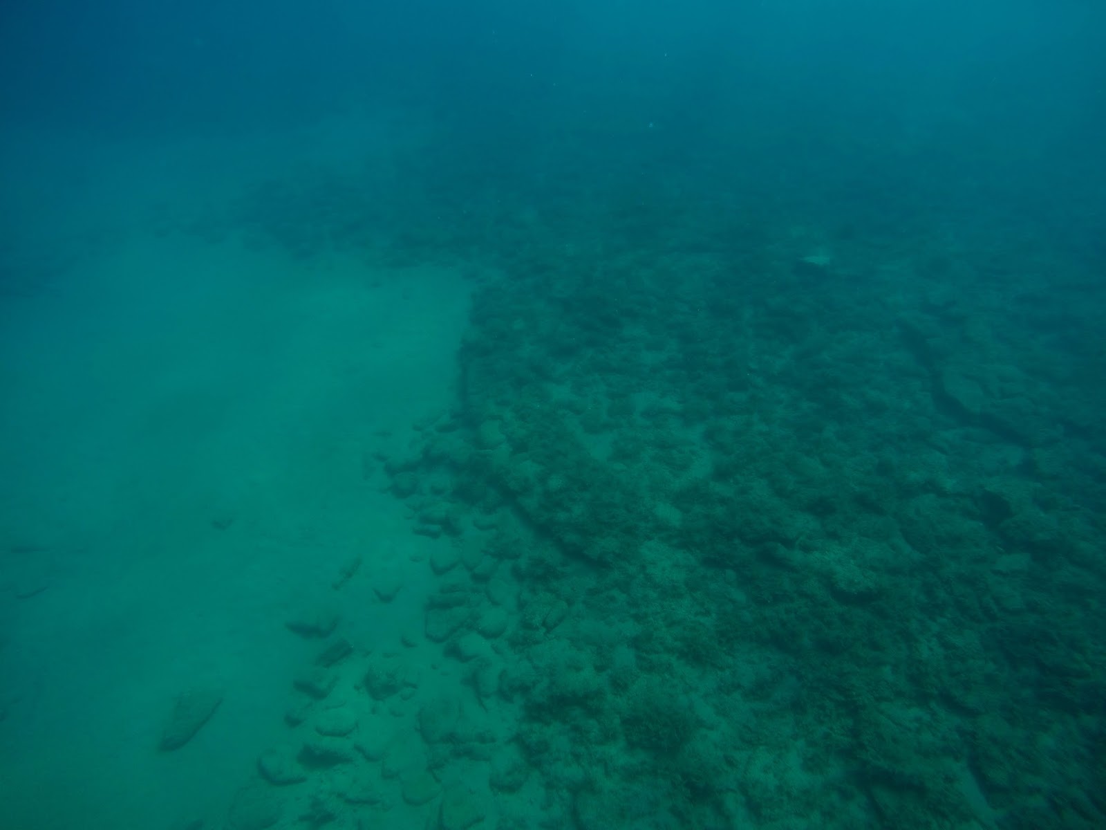
Ruins of a prehistoric submerged settlement off Methoni.
Photo: A. Michael. Source: Hellenic Ephorate of Underwater Antiquities
Photo: A. Michael. Source: Hellenic Ephorate of Underwater Antiquities

Sarcophagi shipwreck off Sapienza island, about a nautical mile south of Methoni.
Photo: Panagiotis Gkionis
Photo: Panagiotis Gkionis

The columns' shipwreck off Sapienza island, about a nautical mile south of Methoni.
Photo: Panagiotis Gkionis

Precise coastlining for the definition of the erosion pattern of the Methoni shoreline.
Photo: K. Tranaka

Surveying the Methoni ancient harbour.
Photo: K. Tranaka
Photo: K. Tranaka

Surveying the Methoni ancient harbour.
Photo: Panagiotis Gkionis
Photo: Panagiotis Gkionis

Surveying the submerged ancient pier of the Methoni ancient harbour.
Photo: Panagiotis Gkionis

3D bathymetric model of the Methoni ancient harbour. Depth soundings are colour-coded.
Data: The evolved GE.N.ESIS project. Background map: Google, TerraMetrics

Sea water multi parameter sensor installation in Methoni.
Photo: K. Tranaka
Setting up a tide gauge in Methoni.
Photo: K. Tranaka

Tidal data retrieval in Methoni.
Photo: K. Tranaka

Tide gauge maintenance.
Photo: Panagiotis Gkionis

Preparing the sub-bottom profiler for shallow seismic survey.
Photo: K. Tranaka

The project team on the survey boat.
Photo: K. Tranaka

The project team afloat, conducting simultaneously sidescan, seismic and magnetometer survey.
Photo: K. Tranaka

The project team afloat, conducting simultaneously sidescan, seismic and magnetometer survey.
Photo: K. Tranaka

Setting up the survey system for simultaneous sidescan, seismic and magnetometer survey.
Photo: K. Tranaka

Surveying the Methoni bay with a marine magnetometer.
Photo: Panagiotis Gkionis

Integrated marine geophysical survey off Methoni.
Photo: Panagiotis Gkionis

Very shallow seismic survey off Methoni.
Photo: Panagiotis Gkionis

Setting up the bathymetric sonar on the survey boat.
Photo: K. Tranaka

Preparing multibeam echosounder survey, on a rainy day.
Photo: A.Michael

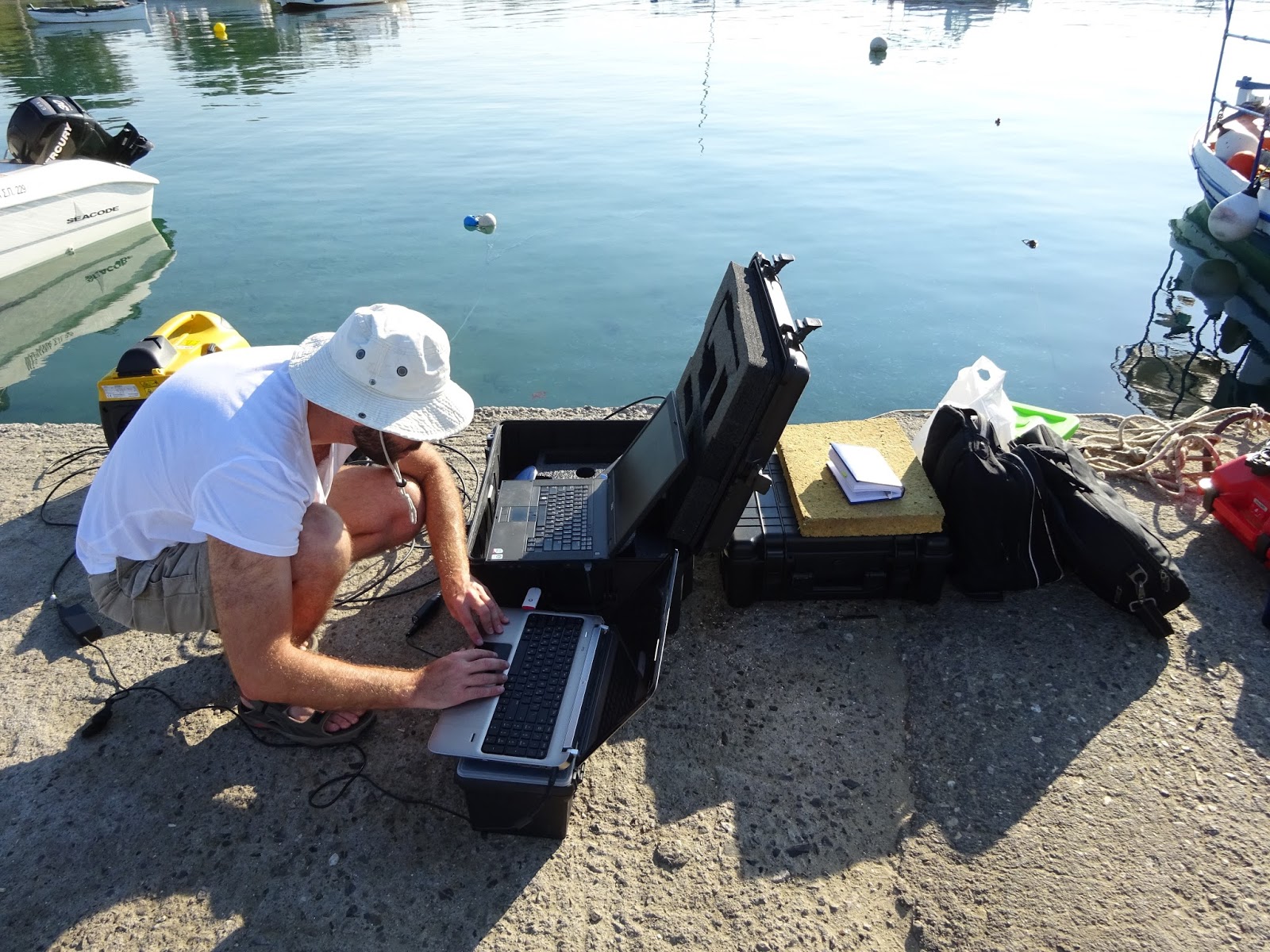
Positioning data Quality Control.
Photo: Panagiotis Gkionis

Photo: K. Tranaka

Photo: Panagiotis Gkionis